
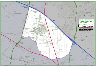
Parish Map
|
Administrative Area
The area extends north to include part of the M1 London to Yorkshire motorway between junctions 15 and 15A. In the west the parish area is bounded by the A43 trunk road connecting Towcester and the M1. This dual-carriageway road was constructed to by-pass the village and Blisworth. It opened in 1991 with access points at junction 15A, Tiffield and Towcester. In the east the parish area is partly bounded by the A508 Northampton to Milton Keynes road, whilst in the south the parish area extends roughly half-way between the main village areas and Blisworth. The West Coast main railway line, which runs from London, Euston, to north west England and Scotland, is just south of the parish. A branch of the line is just east of the main village, running from just south of the parish to Rugby, with stations at Northampton and Long Buckby. Click over the map to see a high-resolution version. You will need to have a copy of Adobe Reader installed on your computer; if you don't have a copy, you can download the reader from the Adobe web site. |
|
Facilities
There are a small number of working farms. A number of business premises are also located in the parish, including an industrial and office estate in Gayton Road, small office units at Maple Farm, Collingtree Road, a small office block at the former Hope Brewery, Towcester Road and an architects’ office, at the Old Rectory, Rectory Lane. Retail premises include one public house: The Greyhound, Towcester Road and a village shop on the High Street. There are two churches: Holy Cross Church (CofE) and the Baptist Chapel. Milton Primary School serves the village and surrounding areas including Northampton’s southern suburbs. There is also a care home for the elderly (Holly House) in the main village. The Grand Union Canal runs close to the west of the Parish with a large marina. The village is in the catchment area of Campion School in Bugbrooke which is a Language College.
Political Administration
Other administrative areas comprise:
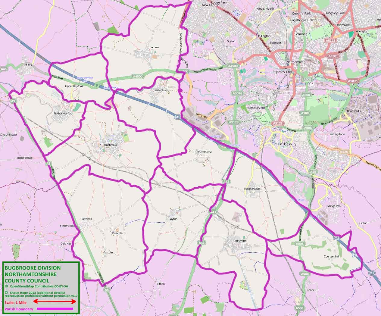
A map of Bugbrooke Division shows the 11 parishes - the division has just over 10,000 electors. The Northamptonshire County Council web site has more details of the Local Government Boundary Commission review.
There are a small number of working farms. A number of business premises are also located in the parish, including an industrial and office estate in Gayton Road, small office units at Maple Farm, Collingtree Road, a small office block at the former Hope Brewery, Towcester Road and an architects’ office, at the Old Rectory, Rectory Lane. Retail premises include one public house: The Greyhound, Towcester Road and a village shop on the High Street. There are two churches: Holy Cross Church (CofE) and the Baptist Chapel. Milton Primary School serves the village and surrounding areas including Northampton’s southern suburbs. There is also a care home for the elderly (Holly House) in the main village. The Grand Union Canal runs close to the west of the Parish with a large marina. The village is in the catchment area of Campion School in Bugbrooke which is a Language College.
Political Administration
Other administrative areas comprise:
- West Northamptonshire District Council: Harpole and Grange ward
- Northamptonshire County Council: Bugbrooke Division which covers 11 parishes including Milton Malsor
- Parliamentary Constituency: Daventry
A map of Bugbrooke Division shows the 11 parishes - the division has just over 10,000 electors. The Northamptonshire County Council web site has more details of the Local Government Boundary Commission review.
This page last updated 14-04-2019